The spring snow is rapidly vanishing in the local hills, and I wanted a tougher test for my system of replacing hiking boots with trail runners. On May 21 I suggested to my hiking buddy that we leave the skis behind and head up for a local bushwhack. Click here for a full description of the system.
Disclaimer and warning: this article describes a route that is potentially dangerous, and is therefore not a recommended hike. A fall is very possible and could be fatal. The north face of Hollyburn Mt. is very steep, gnarly, and drops into a deep gully. Rescue would be difficult. Although this is close to urban Vancouver, the old trail is no longer completely marked, and the spring conditions increase the hazard. Wayfinding is difficult, the weather is changeable and very different from that at sea-level, and there are no easy ‘escape’ routes. This article is a report, and is not advice to adventurers.
I had heard that there was an old trail that leads from Mt. Strachan, over to Hollyburn Mt. via a steep ridge. I thought we’d be on spring snow most of the way, and the steepness would give me a sense of how the Saucony trail runners and Microspikes managed in conditions that are typical in these mountains. Since I am taking the pictures, you are looking at my companion, yet I am discussing my experience with my footwear. These are thumbs, click for full-size images.
 The ‘system’ is a Saucony trail runner with Gore Tex, Microspikes, and short gaiters. |
 GPS track on Hollyburn Mt. Note the drop-off to the climbers’ left. |
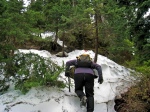 A tag on a tree showed that the beginning of the trail was a narrow vertical line with a horrific drop to the left. |
 At first we were on and off snow. The Microspikes provided me some grip on both. There were no more trail markers and we were just bushwhacking. |
 Side-hilling meant kicking my shoe into the slope. I love being up and alone in these high old forests. |
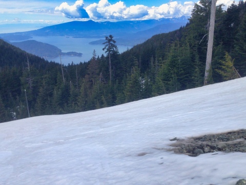
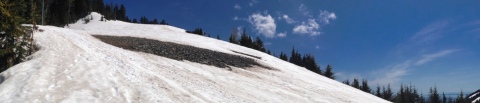
 We had to navigate a number of these short steep snow pitches |

As we emerged onto the summit dome we looked back and saw the warning sign.
What worked with those shoes, and what didn’t? Generally, I am thrilled with the system. The runners are not boots, and kicking steps in the snow worked because while the snow was often hard, it was not icy. Runners are much softer than boots, so I was kicking tiny toe-holds and I blew out more steps than I would have with boots, but I never really felt insecure. The Microspikes are not as aggressive as crampons, which meant that when it was really steep I could not keep them from slipping — I was better to kick a hole for my toe, or better-yet, zig-zag up the slope in a diagonal ascent. For this manoeuvre I was kicking the side of my shoe into the slope until I had a little shelf to stand on. Here, I found I had to be careful. While boots would provide the support to keep my foot flat, the runners could allow my ankles to roll out and lose the grip on the hill. It required a slight adjustment to my technique.
After an hour or so with the shoes constantly in the snow, my feet became cold. This didn’t bother me because this has always happened with my hiking boots. Also, the boots became much heavier as they became wet. The runners are so light that I was amazed at how easily I could keep climbing. I felt 15 years younger. For me, this is a wonderful revelation! There was a bit of sun and dry rock at the summit, so as we rested I took off my shoes. By that time my feet had already begun to warm, and I was pleased to find that my feet were dry! I am very impressed with the Gore Tex liner in these shoes. While on the way down the benign southern aspect of Hollyburn, plunge stepping down every steep slope I could find was fun. At one point I put my foot through a cavity under the snow and into a stream of melt-water up to my ankle. My ankle came out damp, but my foot stayed dry. The next weekend we were back in the hills where the heavy rains had produced several inches of new snow at the top. I happily tramped through the spring snow in my runners. Microspikes are for more than ice: I am pleased at the security that the Microspikes provided walking across wet and sometimes mossy ground where the snow had melted.
Conclusions: These runners are not for mid-winter, high altitude, cold hiking and climbing. For everything else, they are truly a breakthrough development for my hiking. I will try warmer socks for the shoulder seasons.


Recent Comments